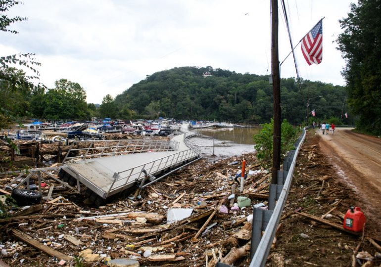
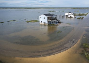
As Hurricane Milton hurtles toward Florida, parts of four states—Georgia, North Carolina, Virginia, and Tennessee—are still struggling with unprecedented damage from Hurricane Helene. The storm stunned many by decimating communities far inland and long after landfall, hitting places rarely impacted by hurricanes directly.
[time-brightcove not-tgx=”true”]
Yet, as unique as Helene seemed, Americans have seen something like it before.
In 1969, Hurricane Camille dropped 27 inches of rain on Nelson County, Va., in just six hours. The storm hit the Blue Ridge Mountains with an intensity that no meteorologist had anticipated, and sleeping Virginians awoke to find their houses buried in muddy boulders or floating down what had previously been trickling streams. Catastrophic flash flooding killed 153 people — more than one percent of Nelson County’s population—and obliterated entire towns. Fifty-five years later, Camille remains the deadliest and costliest natural disaster in Virginia’s history.
Never had a hurricane inflicted such damage and claimed so many lives so far into the nation’s interior. The destruction wrought by Camille reshaped both disaster preparedness and disaster response in the U.S. Yet, over time, Americans forgot about the storm because its most destructive lesson remained almost a local secret. Even the swan song of a hurricane can cause catastrophic flooding and landslides if it collides with the mountainous areas of Virginia, North Carolina, and Tennessee — and their deep hollows veined with creeks and streams that carry run-off into the river valleys of the Piedmont. And when they do, the result is generally more lethal than the impacts seen on the coasts.
Now that we’ve seen another catastrophic hurricane that looked awfully similar to Camille, it ought to finally prompt a wholesale rethinking of how we handle the arrival of large storms in areas far away from the coast.
No one feared for the heart of Appalachia when Camille made landfall at Waveland, Miss., on Aug. 17, 1969. The focus was on the coast, and rightfully so, as Camille’s nearly 200 mile-per-hour winds wrought unprecedented devastation while driving north through Mississippi. Mercifully, due to its incredible force, rain amounts were scant and flooding minor because it moved through the state so quickly.
Read More: Helene’s Death Toll Reaches 200 as Crews Try to Reach Remote Areas Hit
After leaving Mississippi, Camille made a hard right turn, and quickly lost steam as it moved east, passing over Tennessee and Kentucky as a tropical depression. As the storm’s sputtering low pressure remnants headed toward Appalachia, residents of the mountains were assured the worst had passed. Few would’ve believed that Camille had saved most of its rain load for the area around tiny Massie’s Mill, Va.
The storm’s ferocity when it hit Virginia owed to a rare confluence of events — but one that was part of the DNA of the Blue Ridge mountains. The summer of 1969 had been abnormally wet, leaving the soil in the area saturated. Then as Camille made its way to Central Virginia, another storm system took aim at the region from the North. Both encountered the upsloping winds of the Blue Ridge that push air into the colder higher cloud masses. This process triggered a torrent of rain that rapidly overwhelmed the drainage system.
Waterways choked with debris soon burst, taking 20-ton boulders, two-story houses — and even a 95-foot CSX bridge with them.
Residents received no warning of the impending catastrophe because there was no system to warn of flash-flooding in the area. In fact, weather stations in the region shut down at night. Most people had no time to prepare or even to understand what was happening. They fled their homes into rain falling so hard one survivor said he had to cup his hands over his face just to breathe. Those fortunate enough to be tossed into trees—often naked from the force of the water stripping off their clothes—survived clinging to branches above the deluge all night.
For months, residents undertook a tortured search for family members lost to raging flood waters. Parents were haunted by losing their grip on their children. Children were filled with guilt because they had survived while their siblings perished. Some never found out what happened to their loved ones.
The location of the storm severely hampered the distribution of aid. Whereas relief agencies could easily access coastal areas crisscrossed with highways, the rural county’s minimal infrastructure blocked access to some areas for weeks.
Furthermore, at the time, a blizzard of government agencies existed to handle catastrophes, but their primary mission was planning to handle the fallout of a nuclear war. That orientation left them focused on addressing the aftermath of disasters in urban areas, which meant they were ill-equipped to address the destruction in Appalachian Virginia.
Confusion abounded as to who would be eligible for a slew of government relief programs. Congress had just passed the National Flood Insurance Program in 1968, but implementation had been haphazard. The program only ended up reimbursing 20 percent of Camille’s victims. Meanwhile, predatory insurance agents descended shortly after the storm, bilking people into signing waivers for small payouts instead of filing claims.
Read More: See Photos of Hurricane Helene’s Devastation in North Carolina
The devastation prompted a wholesale rethinking about how the federal government handled storms. At the National Hurricane Center (NHC), Director Robert Simpson examined the destruction in the Gulf and decided that the U.S. needed a much simpler warning system for hurricane strength. He collaborated with a structural engineer, Herbert Saffir, to develop the now familiar Saffir-Simpson Hurricane Wind Scale, which places storms in five categories. (Camille was only one of two named storms to make landfall in the continental U.S. as a Category Five.)
Congress also took action—passing the Coastal Zone Management Act in 1972 to protect flood plains and control erosion, and the Disaster Relief Act in 1974 to streamline aid distribution. These laws further extended the role of the federal government in coordinating disaster prevention and recovery. In 1979, legislators fully nationalized the handling of disasters with the creation of the Federal Emergency Management Agency (FEMA).
These protections, and a lull in major hurricane activity, fueled an influx of people to the Gulf and Southern Atlantic coasts in the 1970s and 1980s. As the federal government shouldered increasing responsibility for disaster management, it encouraged developers to pour money into these precarious zones, raising expectations of protection and relief further still. At the same time, the tension between “defense” and “disaster” continued, with FEMA demoted to a subagency of the Department of Homeland Security after 9/11.
Then, in 2005, Hurricane Katrina hit New Orleans, which launched a new era of demands for hurricane disaster management in the age of rising sea levels and warming oceans. But Katrina also inadvertently reinforced the association of hurricanes exclusively with coastal devastation in the public’s mind. Mudslides on the Blue Ridge Parkway was not part of this imagery.
Instead, Americans came to see mountainous places as offering a haven from sea-level rise and coastal flooding — whether or not that had ever been true.
The warnings that they had heard from officials and in the media before major storms may have fueled a false sense of security. A Center for Disease Control (CDC) report on Hurricane Opal in 1995, which left three dead in Macon, N.C., had noted that, while there had been a marked decrease in hurricane deaths at impact sites on the coasts, inland deaths had increased since the time of Camille. The problem had to do with how officials categorized storms. By evaluating hurricanes based on wind strength, it lulled people inland into complacency because it was rain, more so than wind, that posed a threat for them.
Four years after Opal, inland flooding from Hurricane Floyd had killed over 50 people in the North Carolina’s Piedmont, 10 times the death rate seen on its coast. An NHC pamphlet published in its aftermath had underscored that weaker tropical storms threatened worse damage inland due to their habit of stalling out when slogging through the mountains. The point was brought home in September of 2004, just a year before Katrina, when back-to-back strikes from Hurricanes Frances and Ivan killed 11 in the same area Helene struck.
The risk of another Camille—in Nelson or somewhere similar—was never lost on locals in the region. Yet, Helene has once more reminded the rest of the country that the sense of security in the mountains is a mirage. Mountainous areas should prepare for hurricanes as much as Americans living along the coast do.
Helene did not reveal a hidden or unprecedented risk — it revealed something forgotten.
Justin McBrien is an environmental historian teaching at the University of Virginia and postodoctoral fellow for the National Science Foundation’s Coastlines and Peoples Hubs for Research and Broadening Participation (CoPe). He lives in Charlottesville, Va.
Made by History takes readers beyond the headlines with articles written and edited by professional historians. Learn more about Made by History at TIME here. Opinions expressed do not necessarily reflect the views of TIME editors.
Leave a comment


