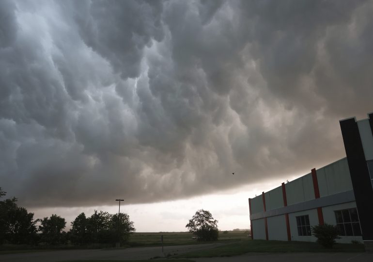
OKLAHOMA CITY — At least two people are dead after severe weather swept across Texas and Oklahoma overnight, causing extensive damage and outages, authorities said.
Sheriff Ray Sappington confirmed the deaths in rural Cooke County in Texas near the Oklahoma border on Saturday night.
“It took some time to get back in there because of all the damage with the power lines, and trees were down. It was kind of a monumental task just to get back to where they were,” Sappington told Dallas television station WFAA.
[time-brightcove not-tgx=”true”]
Forecasters had issued tornado and severe thunder storm warnings for parts of both states, as some heat records were broken during the day in South Texas and residents received triple-digit temperature warnings over the long holiday weekend.
A tornado crossed into northern Denton County in Texas late Saturday and overturned tractor-trailer trucks, stopping traffic on Interstate 35, Denton County Community Relations Director Dawn Cobb said in a statement.
The tornado was confirmed near Valley View, moving east at 40 mph (64 kph), prompting the National Weather Service to issue a tornado warning for northern Denton County, Cobb said.
The storm damaged homes, overturned motorhomes and knocked down power lines and trees throughout the area including points in Sanger, Pilot Point, Ray Roberts Lake and Isle du Bois State Park, Cobb said.
People who suffered injuries in the storm were transported to area hospitals by ground and air ambulances, but the number of injuries in the county was not immediately known, Cobb said, while a shelter was opened in Sanger.
The fire department in the city of Denton, about 37 miles (59.5 kilometers) north of Forth Worth, Texas, posted on X that emergency personnel were responding to a marina “for multiple victims, some reported trapped.”
The Claremore, Oklahoma, police announced on social media that the city about 28 miles (45 kilometers) east of Tulsa was “shut down” as a result of storm damage including downed power lines and trees and inaccessible roads.
Earlier Saturday night, the National Weather Service’s office in Norman, Oklahoma, said via the social platform X that the warning was for northern Noble and far southern Kay counties, an area located to the north of Oklahoma City. “If you are in the path of this storm take cover now!” it said.
A following post at 10:05 p.m. said storms had exited the area but warned of a storm moving across north Texas that could affect portions of south central Oklahoma.
At 10:24 p.m., the weather service office in Fort Worth posted a message warning residents in Era and Valley View they were in the direct path of a possible tornado and to immediately seek shelter. The Forth Worth office continued to post notices and shelter warnings tracking the movement of the storm through midnight and separately issued a severe thunderstorm warning with “golf ball sized hail” possible.
The weather service office in Tulsa, Oklahoma, warned on X of a dangerous storm moving across the northeast part of the state through 2 a.m. and issued severe thunderstorm notices for communities including Hugo, Boswell, Fort Towson, Grainola, Foraker and Herd.
The Norman office had compared conditions Saturday to “ a gasoline-soaked brush pile.” Forecasters said any storms that form could explode with large hail, dangerous winds and tornadoes.
“There’s a small chance most of the matches are duds and we only see a few storms today. Still, that’s not a match I would want to play with. It only takes one storm to be impactful,” it said via Facebook.
Excessive heat, especially for May, was the danger in South Texas, where the heat index was forecast to approach 120 degrees Fahrenheit (49 degrees Celsius) in some spots during the weekend. Actual temperatures will be lower, although still in triple-digit territory, but the humidity will make it feel that much hotter.
The region is on the north end of a heat dome stretching from Mexico to South America, National Weather Service meteorologist Zack Taylor said.
Sunday looks like the hottest day with record highs for late May forecast for Austin, Brownsville, Dallas and San Antonio, Taylor said.
Brownsville and Harlingen near the Texas-Mexico border already set new records Saturday for the May 25 calendar date — 99 degrees Fahrenheit (37 degrees Celsius) and 100 degrees Fahrenheit (38 degrees Celsius), respectively — according to the weather service.
Red Flag fire warnings were also in place in West Texas, all of New Mexico and parts of Oklahoma, Arizona and Colorado. Humidity was very low, under 10%, and wind gusts of up to 60 mph (97 kph) were recorded.
“We’ve got very dry air, warm temperatures and strong winds creating a high fire danger over a wide area … that can lead to rapidly spreading or uncontrollable fires,” Taylor said.
Meanwhile, several inches of snow fell Friday into early Saturday in Rolla, North Dakota, about 10 miles (16 kilometers) from the Canadian border.
April and May have been a busy month for tornadoes, especially in the Midwest. Climate change is heightening the severity of storms around the world.
April saw the United States’ second-highest number of tornadoes on record. So far for 2024, the country is already 25% ahead of the average number of twisters, according to the Storm Prediction Center in Norman.
Iowa was hit hard this week, when a deadly twister devastated Greenfield. And other storms brought flooding and wind damage elsewhere in the state.
The storm system causing the severe weather was expected to move east as the Memorial Day weekend continues, bringing rain that could delay the Indianapolis 500 auto race Sunday in Indiana and more severe storms in Illinois, Indiana, Missouri and Kentucky.
The risk of severe weather moves into North Carolina and Virginia on Monday, forecasters said.
Leave a comment


