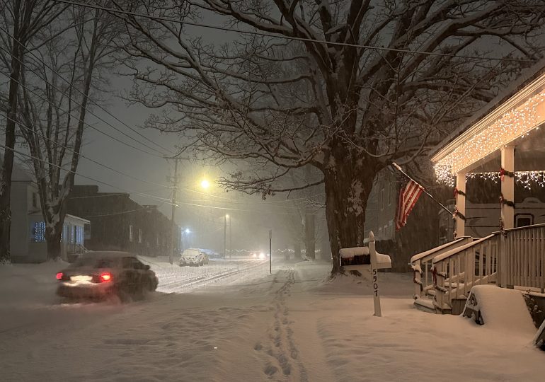
BUFFALO, N.Y. — The first big snowfall of the season is blanketing towns in upstate New York along lakes Erie and Ontario in the middle of the hectic holiday travel and shopping weekend, while numbing cold and heavy snow could persist into next week and cause hazards in the Great Lakes, Plains and Midwest regions.
A state of emergency has been declared for parts of New York, causing problems for scores of Thanksgiving travelers trying to return home.
[time-brightcove not-tgx=”true”]
“Travel will be extremely difficult and hazardous this weekend, especially in areas where multiple feet of snow may accumulate very quickly,” the National Weather Service said Saturday.
Part of I-90 in Pennsylvania was closed Saturday, and as were westbound lanes of the New York Thruway heading toward Pennsylvania.
Nearly two feet (61 centimeters) of snow has already fallen in parts of New York, Ohio and Michigan and some 29 inches (73 centimeters) of snow was recorded in Pennsylvania’s northwestern tip.
This week’s blast of frigid Arctic air also brought bitterly cold temperatures of 10 to 20 degrees Fahrenheit below average to the Northern Plains, the weather service said. That prompted cold-weather advisories over parts of North Dakota.
Cold air was expected to move over the eastern third of the U.S. by Monday, the weather service said, with temperatures about 10 degrees below average.
Parts of Michigan were equally battered by heavy lake-effect snow. A winter storm warning was in effect Saturday through Sunday for regions along Lake Michigan. An additional accumulation of snow of up to 14 inches was expected for the Sault Ste. Marie area. Travel could be difficult or impossible, the weather service said.
While no snow is forecast in the Deep South, the temperatures have dipped below freezing.
“This is the start of our winter season,” said Sam Marlow, a meteorologist with the National Weather Service in Atlanta.
“This morning, we got below freezing for almost all of north and central Georgia.” And in the mountains of northern Georgia, the temperature dipped to about 22 degrees Fahrenheit (-5.5 Celsius)
“We are looking at the temps warming up during the day, getting up to about 50 degrees,” Marlow said.
By Tuesday morning, the low temperature could fall into the teens in isolated parts of Georgia, he said.
As flakes began flying Friday, New York state forecasters warned 4 to 6 feet (1.2 to 1.8 meters) of blowing and drifting snow could fall in Watertown and other areas east of Lake Ontario through Monday.
After an unusually mild fall, as much as 2 to 3 feet (0.6 to 0.9 meters) of snow were possible along Lake Erie and south of Buffalo from lake-effect bands notorious for pummeling the region with snowfall rates of 2 to 4 inches (5 to 10 centimeters) per hour. Lake-effect snow happens when warm moist air rising from a body of water mixes with cold dry air overhead.
“The lake is 50 degrees (10 degrees Celsius). We’re about six degrees above where we should be this time of year, that’s why we’re seeing these heavy lake-effect events,” Erie County Public Works Commissioner William Geary said. “The outlook for the next two weeks into December, we’ll probably see some more.”
New York Gov. Kathy Hochul declared a disaster emergency for the targeted counties, allowing state agencies to mobilize resources. Rapidly deteriorating conditions Friday caused closures along Interstate 90, and tandem and commercial vehicles were banned from Interstate 86 in western New York and much of U.S. Route 219 beginning Friday afternoon.
“There’s a considerable number of vehicles going off the road on the 219 currently,” Gregory Butcher, Erie County deputy director for preparedness and homeland security, said at an afternoon briefing.
ATVs and snowmobiles were being placed around the county to help first responders if necessary, Butcher said.
The Buffalo Bills called for volunteers to potentially shovel snow at Highmark Stadium, where over 2 feet (0.6 meters) of snow was possible before Sunday night’s game against the San Francisco 49ers. Last year, a major lake-effect storm forced the NFL to push back the Bills wild-card playoff home game against Pittsburgh from Sunday to Monday.
“It’s going to be slow going, there’s no doubt about that,” Erie County Executive Mark Poloncarz said, adding the heaviest snow is expected to be over by kickoff.
The team, meanwhile, was preparing to play in any conditions.
“We’re trying to stay on top of it,” coach Sean McDermott said Friday.
The Bills are 9-2, their best start since 1992, and with a win Sunday they would clinch their fifth straight AFC East title.
Leave a comment


